
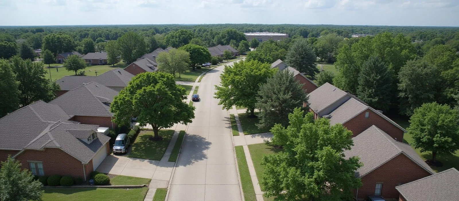
Foundation Repair Across Greater Houston
We work across 40 communities in the Houston area. Several of them span more than one county, so we confirm which permitting authority governs your address before anything is scheduled.
Where We Work Most
These pages cover local soil and drainage context, the permitting jurisdiction, the housing stock we see, and area-specific questions.
Katy, TX
Katy sits over expansive Gulf Coast clay within the greater Houston metro area and spans Harris, Fort Bend, and Waller County permitting jurisdictions. As of 2026, rapid subdivision growth on graded fill - from Cinco Ranch to Cross Creek Ranch - continues to make differential slab movement a distinct residential concern across west Houston, including neighboring Sugar Land and Cypress.
Areas covered: Cinco Ranch, Cross Creek Ranch, Old Katy, Nottingham Country, Grand Lakes
Pearland, TX
As of 2026, Pearland straddles Brazoria and Harris Counties across ZIP codes 77584 and 77546, with newer slab-on-grade subdivisions in Shadow Creek Ranch and Silverlake alongside older homes in the Old Townsite and West Pearland. The area's expansive clay soils, high water table, and position within the Harris-Galveston Subsidence District shape how Houston Foundation Repair evaluates properties here - drainage patterns, soil moisture, and perimeter grading are recorded alongside every relative elevation survey.
Areas covered: Silverlake, Shadow Creek Ranch, Old Townsite, West Pearland
Sugar Land, TX
As of 2026, Sugar Land sits within Fort Bend County over former sugar-plantation fill and Gulf Coast expansive clay, with slab-on-grade construction dominating master-planned communities from First Colony and New Territory through Riverstone, Telfair, and Greatwood. Houston Foundation Repair evaluates single-family homes across all Sugar Land neighborhoods, documenting drainage patterns, irrigation coverage, and perimeter grade alongside each relative elevation survey. Neighboring Missouri City, Stafford, and Richmond share similar Fort Bend County soil and permitting conditions.
Areas covered: First Colony, Riverstone, Telfair, New Territory, Greatwood
Cypress, TX
Cypress sits in unincorporated northwest Harris County over highly active Gulf Coast expansive clay - including Beaumont clay and gumbo clay formations - with limited municipal drainage infrastructure. Seasonal moisture swings between Houston's dry summers and heavy autumn rains drive localized structural movement and heave across subdivisions from Bridgeland to Copperfield. Harris County Flood Control District manages regional drainage, but individual lot grading and MUD-level systems determine how water behaves around your slab. The Cy-Fair ISD attendance zone roughly maps the area we cover most frequently.
Areas covered: Bridgeland, Fairfield, Towne Lake, Coles Crossing, Cypress Creek Lakes, Copperfield, Lakewood Forest
Spring, TX
As of 2026, Spring straddles Harris and Montgomery Counties in the north-Houston fault corridor, where published fault traces, piney-woods soils, and expansive Beaumont clay formations shape how Houston Foundation Repair evaluates properties. Seasonal moisture changes between dry Texas summers and heavy autumn rains drive localized structural movement across subdivisions from Klein and Champions Forest to Gleannloch Farms and Augusta Pines. Neighbouring The Woodlands, Cypress, and Humble share similar north-Houston geology, and we bring that cross-area experience to every Spring evaluation.
Areas covered: Klein, Gleannloch Farms, Old Town Spring, Augusta Pines, Champions Forest, Northgate Forest
Alvin, TX
As of 2026, **Alvin** sits in **Brazoria County** on the Gulf Coastal Plain, where expansive **Beaumont clay soil** is the dominant type and the primary driver of residential foundation movement. Slab-on-grade construction is prevalent across the city's single-family homes, from older properties near the historic downtown core and Alvin Community College to newer subdivisions in Preservation Creek and Hillcrest Village. Seasonal moisture swings between dry Texas summers and heavy autumn and spring rain events change soil volume noticeably, producing differential movement beneath slabs that homeowners report as cracks, uneven floors, and sticking doors. Houston Foundation Repair evaluates each property by recording drainage patterns, perimeter grade, and soil moisture alongside a relative elevation survey - rather than applying a neighborhood-wide soil assumption. Brazoria County permitting applies across most of the city, which simplifies the authority question compared with areas that cross county lines. Homes near Mustang Bayou and other low-lying drainage corridors see more variable soil moisture than properties on higher ground along TX-35, so drainage and lot grade conditions are documented on every evaluation. Concrete leveling for driveways, patios, and walkways is a separate service from structural foundation work, and we assess both when the situation calls for it. Neighboring Pearland, Friendswood, and League City share similar Gulf Coast clay conditions, and cross-area experience shapes how we read every Brazoria County property.
Areas covered: Downtown Alvin, Hillcrest Village, Preservation Creek, Austin Bayou District, West Alvin, Southeast Alvin
Manvel, TX
As of 2026, **Manvel** sits in northern **Brazoria County** on the Gulf Coastal Plain, where rapid residential growth has brought master-planned communities including **Sedona Lakes**, **Rodeo Palms**, **Meridiana**, and **Pomona** onto former agricultural land. Slab-on-grade construction dominates throughout, and fill placement and grading history vary between developments - which is one reason two homes in the same subdivision can behave differently. Seasonal moisture swings between dry Texas summers and heavy autumn and spring rainfall change **Beaumont clay** soil volume noticeably, producing differential movement beneath slabs that homeowners report as cracks, uneven floors, and sticking doors. Houston Foundation Repair evaluates each property by recording drainage patterns, perimeter grade, and soil moisture alongside a relative elevation survey, rather than applying a subdivision-wide assumption. **Brazoria County** permitting covers most Manvel addresses, with requirements that differ from Harris County jurisdictions to the north. The city sits at the intersection of TX-288 and SH-6, giving direct access via the TX-288 corridor to Houston. Concrete leveling for driveways, patios, and walkways is a separate service from structural foundation work, and we assess both when the situation calls for it. Neighboring Pearland, Alvin, and Friendswood share similar Gulf Coast clay conditions, and cross-area Brazoria County experience shapes how we read every evaluation.
Areas covered: Sedona Lakes, Rodeo Palms, Meridiana, Pomona, Del Bello Lakes, Bluewater Lakes, Newport Lake Estates
Brookshire, TX
Brookshire sits in southern Waller County on the I-10 corridor about 30 miles west of Houston, over the same Gulf Coast **expansive clay** formations - Beaumont and Lissie - the type of expansive soil that drives most residential foundation movement across the greater Houston metro. As of 2026, Waller County is experiencing growth pressure from the expanding Katy and Fulshear footprint to the east and south, with new residential development on land that was recently agricultural. Fill placement and grading history vary significantly between older US-90 corridor homes and newer FM 359 subdivisions, and that variability is one reason two adjacent properties can behave differently after a wet season. Houston Foundation Repair evaluates single-family homes throughout the Brookshire area, recording drainage patterns, perimeter grade, and soil moisture conditions alongside every **relative elevation survey**. The area's low municipal density means surface drainage often relies on ditches and private lot grading rather than city infrastructure - a factor we document rather than assume when evaluating properties near Pattison and the FM 359 corridor. **Waller County permitting** governs most addresses here, including properties in the Royal ISD attendance zone near Hovas Park and Bostick Park, and we confirm jurisdiction before scheduling.
Areas covered: Pattison, East Brookshire, FM 359 Corridor, US-90 Corridor, Royal ISD District
Waller, TX
As of 2026, Waller sits in Waller County along the US-290 northwest corridor, with communities including Prairie View, Hempstead, and Monaville sharing the same **Gulf Coast expansive clay** that drives differential foundation movement across the greater Houston region. The county's residential housing spans older in-town properties through to newer slab-on-grade construction along the US-290 and Grand Parkway corridors, and the clay soils respond to seasonal moisture swings between dry Texas summers and heavy autumn rains. Properties near the eastern edge of Waller County - where the county borders Harris County toward Katy and Cypress - may cross permitting jurisdictions depending on the address. Houston Foundation Repair confirms the applicable authority before scheduling any foundation work, including any plumbing permit required when **post-lift hydrostatic testing** is part of the scope. Active development along the US-290 and Grand Parkway corridors means graded-fill construction concerns exist alongside older housing stock in Prairie View and Hempstead. The county's low municipal density means surface drainage often relies on private lot grading and roadside ditches rather than city infrastructure - a factor we document rather than assume during evaluations. Every evaluation records tree proximity, irrigation coverage, and **perimeter grade** alongside the relative elevation survey, because those site-specific variables explain what the elevation numbers actually mean for a given property.
Areas covered: Prairie View, Hempstead, Monaville, US-290 Corridor, FM 362 Corridor
Dickinson, TX
Dickinson sits in Galveston County along I-45 between the Greater Houston area and Galveston Island, over **Gulf Coast expansive clay** that responds to seasonal moisture swings and the bayou's influence on local water table conditions. As of 2026, both established slab-on-grade subdivisions like Bay Colony and Sago Palm and older homes in the Old Dickinson core show the same recurring pattern: foundation settlement driven by clay soil shrinkage during dry periods and expansion after heavy rain events, producing drywall cracks, sticking doors, and uneven floors across the area. Houston Foundation Repair - rated 4.9/5 across 180+ homeowner reviews on Google and BBB - evaluates single-family homes across all Dickinson neighborhoods, recording drainage patterns, **perimeter grade**, and soil moisture history alongside every relative elevation survey. Dickinson Bayou and its tributaries have shaped drainage and soil saturation conditions across much of the city, and flood events along the corridor have accelerated wet-dry cycles that affect how the clay behaves under a slab. Neighboring League City, Friendswood, Texas City, and the broader Clear Creek and Galveston Bay corridor share similar geology and soil conditions, and we bring that cross-area experience to every local evaluation. Galveston County permitting governs foundation work for most city addresses. We confirm the applicable authority before scheduling any work, handle the permit where one is required, and coordinate any **post-lift hydrostatic testing** or plumbing inspection required by scope.
Areas covered: Bay Colony, Old Dickinson, Sago Palm, North Dickinson, South Dickinson, I-45 Corridor
Texas City, TX
As of 2026, Texas City sits on the north shore of **Galveston Bay** in Galveston County, where Gulf Coast **expansive clay** soils and a coastal water table shape every foundation evaluation conducted here. The city's housing ranges from 1950s-1970s slab-on-grade homes in **Moses Lake** and **Highland Heights** to newer residential construction near **La Marque** and **Lago Mar**, with portions of the city sitting on fill placed over former wetland and tidal flat areas. Seasonal moisture swings between dry Gulf Coast summers and the region's wetter periods drive soil volume changes that produce differential foundation movement across all neighborhoods. Proximity to Galveston Bay means soil conditions can shift noticeably across short distances - properties near tidal areas may sit on a different fill and compaction history than higher-ground inland sections. Houston Foundation Repair records drainage patterns, perimeter grade, and soil moisture conditions alongside every relative **elevation survey**, because moisture consistency around the slab is often the most useful factor to understand before drawing any conclusions. Neighboring **Dickinson** and **League City** share similar Galveston County soil conditions, and we bring cross-area experience to every Texas City evaluation. **Galveston County** permitting governs foundation work across the city. Repair methods used here include **steel piers**, **drilled bell-bottom concrete piers**, and **pressed concrete pilings**, with the approach determined by evaluation findings and site conditions rather than by address or symptom alone. Post-lift **hydrostatic plumbing testing** is coordinated where the scope calls for it, and the permit process is confirmed before scheduling rather than discovered mid-project.
Areas covered: Moses Lake, Highland Heights, La Marque, Texas City Prairie, Lago Mar
Mont Belvieu, TX
As of 2026, **Mont Belvieu** sits approximately 30 miles east of central Houston in **Chambers County**, where I-10 and TX-146 intersect at the outer edge of the greater Houston metro. Residential development concentrates around **Eagle Drive** and the **Barbers Hill** community, with newer master-planned subdivisions built on Gulf Coast expansive clay soils subject to seasonal moisture-driven shrink-swell cycles. Rapid growth has brought slab-on-grade construction on graded fill across multiple sections, and differential foundation movement is a documented concern in these newer residential areas. Chambers County's expansive clay responds strongly to seasonal wet-dry cycles, and the area's position near the Trinity River corridor means drainage and soil moisture conditions can vary noticeably between nearby lots. Houston Foundation Repair records perimeter grade, irrigation coverage, drainage discharge points, and standing-water evidence alongside every relative **elevation survey** conducted here, because moisture consistency around the slab perimeter is often the most informative context before drawing conclusions. Neighboring **Baytown** and Deer Park are within our regular dispatch area and share similar east Houston soil conditions. **Chambers County** permitting governs foundation work throughout the city. Repair methods include **steel piers**, **drilled bell-bottom concrete piers**, and **pressed concrete pilings**, with the approach determined by evaluation findings and site conditions rather than address or symptom alone. Post-lift **hydrostatic plumbing testing** is coordinated where the scope calls for it, and permit requirements are confirmed before scheduling.
Areas covered: Eagle Drive, Barbers Hill, Old Town Mont Belvieu, Cove, North Mont Belvieu
Montgomery, TX
As of 2026, **Montgomery** sits in western **Montgomery County** approximately 50 miles northwest of central Houston along **TX-105**, where the small historic town meets a growing ring of **Lake Conroe** waterfront communities including **Walden on Lake Conroe**, **April Sound**, and **Bentwater**. The area's soils transition from Gulf Coast expansive clay in lower lake-edge elevations to sandy loam typical of East Texas piney woods terrain, producing site-specific conditions that differ between lakefront lots and the hillier ground along the **FM 149 corridor**. Crew access runs via TX-105 from Conroe and FM 149 from the south, with FM 1097 serving the Lake Conroe shoreline communities. Rapid residential growth in Lake Conroe waterfront subdivisions has brought slab-on-grade construction on varied fill, and differential movement is a documented concern in newer sections near the shoreline. Houston Foundation Repair records perimeter grade, drainage discharge points, tree proximity, and soil moisture alongside every relative elevation survey, because lakefront and upland properties respond differently to seasonal wet-dry cycles. Neighboring **Conroe** and **Magnolia** are within our regular dispatch area. **Steel piers**, **drilled bell-bottom concrete piers**, and **pressed concrete pilings** are applied here, with the method determined by evaluation findings rather than address or symptom. Post-lift **hydrostatic plumbing testing** is coordinated where the scope requires it, and the correct permit authority is confirmed before scheduling to avoid mid-project delays.
Areas covered: Walden on Lake Conroe, April Sound, Bentwater, Historic Downtown Montgomery, Panorama Village, FM 149 Corridor
Shenandoah, TX
**Shenandoah** sits in southern **Montgomery County** along **I-45**, approximately nine miles south of Conroe and directly adjacent to **The Woodlands** to the north. The city is one of the smallest incorporated in Texas by land area, but its position along the I-45 corridor and **Research Forest Drive** makes it a crossover point between The Woodlands' research and medical communities and the Spring area to the south. Residential construction in and around the city is predominantly slab-on-grade, built over expansive **Gulf Coast clay** - the Beaumont and Lake Charles formations that drive seasonal shrink-swell movement across the north-Houston corridor. Crew access runs primarily via **I-45** and Research Forest Drive (TX-242), with College Park Drive and Panther Creek Road serving residential sections west of the freeway. Seasonal soil movement here follows the same north-Houston pattern: dry Texas summers pull moisture from the clay and cause perimeter settlement, while heavy autumn rains rehydrate the soil and can produce localized heave. Houston Foundation Repair records perimeter grade, drainage discharge points, tree proximity, and irrigation coverage alongside every relative elevation survey - because the moisture balance around the slab is often the most informative context we can document. **Montgomery County** permitting applies to addresses within the city limits and the unincorporated areas to the south and west. We confirm the correct authority before scheduling, including any plumbing permit tied to post-lift **hydrostatic testing** where the scope requires it.
Areas covered: Shenandoah Valley, College Park, Research Forest, Metropark Square, Portofino Center, Panther Creek corridor
Willis, TX
**Willis** sits approximately 50 miles north of central Houston in northern **Montgomery County**, positioned along **I-45** (North Freeway) just north of Conroe. The city serves as a gateway to the **Lake Conroe** recreational corridor and the western edge of **Sam Houston National Forest**, with residential development ranging from established neighborhoods near the historic town center to newer subdivision growth along **FM 1097** and **FM 1314**. The area's soils include expansive Gulf Coast clay in lower-lying sections and transitional material toward sandy loam typical of East Texas piney woods terrain, producing site-specific conditions that differ noticeably between lots across short distances. Rapid residential growth north of Conroe has brought slab-on-grade construction on graded fill to sections including **Lake Conroe Forest** and the **Chambers Creek** corridor, where differential foundation movement is a documented concern in homes less than a decade old. Dry Texas summers pull moisture from expansive clay and can cause perimeter settlement, while heavy autumn rainfall rehydrates the soil and may produce localized heave. Houston Foundation Repair records perimeter grade, drainage discharge points, tree proximity, and irrigation coverage alongside every relative elevation survey conducted here, because moisture consistency around the slab perimeter is often the most informative context to establish before drawing conclusions. **Montgomery County** permitting governs foundation work throughout the city. Repair methods include **steel piers**, **drilled bell-bottom concrete piers**, and **pressed concrete pilings**, with the approach determined by evaluation findings and site conditions rather than address or symptom alone. Post-lift **hydrostatic plumbing testing** is coordinated where the scope calls for it, and the correct permit authority is confirmed before scheduling.
Areas covered: Willis Proper, Lake Conroe Forest, Chambers Creek, FM 1097 Corridor, SH-75 Corridor, North Montgomery County
Atascocita, TX
**Atascocita** is an unincorporated community in **Harris County**, situated northeast of central Houston along the **US-59 / I-69** (Eastex Freeway) corridor and the western shore of **Lake Houston**. The community encompasses established subdivisions - including **Atascocita Shores**, **Atascocita Forest**, and **Kings Forest** - as well as newer master-planned developments like **Summerwood**, **Fall Creek**, and **Balmoral**, which continue to add residential density along **FM 1960** (Will Clayton Parkway). Beneath much of the area lie expansive clay soils - the same Gulf Coast clay formations found across the greater Houston, TX metro - that respond to seasonal wet-dry cycles, driving differential foundation movement in both older and recently constructed homes. Newer concrete slab homes in Summerwood, Fall Creek, and Balmoral were frequently built on engineered or graded fill, and the compaction history beneath individual lots varies within a single subdivision. Perimeter settlement on residential properties only a decade old is not uncommon, particularly along drainage corridors near Lake Houston where soil moisture fluctuates more than on elevated lots toward Humble and Kingwood. Mature trees are common in these older lakeside neighborhoods, and root-related moisture withdrawal near slab edges is a documented contributor to differential movement. Houston Foundation Repair records tree proximity, irrigation coverage, perimeter grade, and drainage discharge points alongside every relative elevation survey conducted here. As of 2026, **Harris County** permitting governs foundation work throughout the area. Repair methods include **steel piers**, **drilled bell-bottom concrete piers**, and **pressed concrete pilings**, with the appropriate approach determined by evaluation findings and site conditions. Post-lift **hydrostatic plumbing testing** is coordinated where the scope calls for it, and the permit authority is confirmed before scheduling.
Areas covered: Atascocita Shores, Atascocita Forest, Kings Forest, Summerwood, Fall Creek, Lakeshore, Walden on Lake Houston, Balmoral
Crosby, TX
**Crosby** is an unincorporated community in eastern **Harris County**, situated along the **US-90** (Crosby Freeway) and **FM 2100** corridors, bordered by **Lake Houston** to the west and the **San Jacinto River** to the southwest. The community encompasses established residential areas near the historic town center alongside the **Newport** master-planned community along the Lake Houston shoreline, with the adjacent **Highlands** community extending south toward Baytown. Beneath most of the area lie expansive Gulf Coast clay formations that respond strongly to seasonal wet-dry cycles, driving differential foundation movement in both older homes and recently constructed slab-on-grade developments. Newer construction in Newport, Newport Country Club Estates, and Stonebridge was built on graded fill over expansive clay, and perimeter settlement in homes less than a decade old is a documented concern, particularly along drainage corridors near Lake Houston where soil moisture fluctuates more than on elevated lots. Older homes in Crosby Proper and Barrett represent earlier housing stock with a range of foundation types, and mature trees near slab edges are a recognized local factor. Houston Foundation Repair records tree proximity, irrigation coverage, perimeter grade, and drainage discharge points alongside every relative elevation survey conducted here. **Harris County** permitting governs foundation work throughout the area. Repair methods include **steel piers**, **drilled bell-bottom concrete piers**, and **pressed concrete pilings**, with the approach determined by evaluation findings and site conditions. Where plumbing leaks beneath the slab are suspected, a separate plumbing assessment is coordinated before or alongside foundation work. Post-lift **hydrostatic plumbing testing** confirms line integrity after leveling, and every project includes a **transferable warranty** with coverage limits explained before work begins.
Areas covered: Newport, Newport Country Club Estates, Stonebridge, Crosby Proper, Barrett, Highlands, Indian Shores, Pinewood
Jersey Village, TX
Jersey Village is a small incorporated city in northwest Harris County - part of the greater Houston, TX metro - built largely on concrete slab (slab-on-grade) homes from the 1960s through the 1980s. The city sits over **Houston Black Clay**, one of the most expansive soil types in the Houston metro, which means seasonal moisture changes between dry summers and wet autumn rains drive genuine structural movement across subdivisions from Jersey Meadow and Equestrian Village to Canterbury Village and Steeplechase. The proximity of **White Oak Bayou** and the city's documented flood history create a specific local context for foundation evaluations. Where post-flood soil saturation or drainage changes have altered moisture patterns around a slab perimeter, those conditions affect elevation readings - so Houston Foundation Repair documents drainage patterns, perimeter grade, and irrigation coverage alongside every relative elevation survey conducted here. The city operates as its own municipality with a distinct permitting authority, which is simpler than the unincorporated Harris County process for neighboring Cypress. Most residential work is processed through City of Jersey Village permits, though plumbing work tied to post-lift hydrostatic testing involves coordination with the appropriate inspection authority. We confirm the correct process before scheduling. Evaluations proceed year-round, though drier periods offer clearer baseline elevation readings before autumn rains shift soil moisture. Concrete leveling for settled driveways, walkways, and patio slabs is a separate scope from structural foundation repair, and both services are available across Jersey Village.
Areas covered: Jersey Meadow, Equestrian Village, Canterbury Village, Steeplechase, West Jersey Village, Castlebridge, Heights of Jersey Village
Kingwood, TX
Kingwood is a master-planned community in northeast Harris County, developed from the early 1970s, with slab-on-grade construction dominating across its established villages - from **Kings Forest** and Woodland Hills to **Atascocita Shores** and Lake Shore Harbour. The community sits over Beaumont Formation expansive clay in the east Harris County corridor, where seasonal moisture changes between dry Texas summers and heavy autumn rains drive localized differential movement across heavily wooded single-family lots. The 2017 Hurricane Harvey flooding affected many properties here, and as of 2026, documented flood history across **Forest Cove**, River Grove, and Kings Mill remains relevant context for any foundation evaluation. Repeated saturation cycles alter how soil moisture redistributes around a slab perimeter, which directly affects elevation readings. Houston Foundation Repair documents drainage patterns, lot grade, tree proximity, and prior flooding evidence as part of every relative elevation survey conducted in the area. A City of Houston address governs permitting here despite the community's distinct master-planned character. Foundation work is processed through the City of Houston building department. We confirm the applicable requirements for your specific address before scheduling, including any plumbing permit and inspection coordinated alongside post-lift hydrostatic testing. Neighboring **Humble** and **Atascocita** share similar northeast Harris County soil conditions and fall within our regular dispatch area for residential foundation repair, house leveling, and concrete leveling.
Areas covered: Kings Forest, Atascocita Shores, Forest Cove, Woodland Hills, Kings Mill, Kingwood Village, Lake Shore Harbour, River Grove
La Porte, TX
La Porte is a residential city in eastern Harris County, positioned along **Galveston Bay** and adjacent to the Houston Ship Channel corridor. Homes here are predominantly slab-on-grade, built on Gulf Coast expansive clay that expands with seasonal moisture and contracts during dry Texas spells. That shrink-swell cycle is particularly evident in the **Fairmont Park** cluster and the Pecan Plantation area, where differential movement under a slab edge can produce sticking doors, uneven floors, or perimeter cracks. Flood exposure is part of the local record. Repeated soil saturation from storm events - including Hurricane Harvey in 2017 - can alter how moisture redistributes around a slab perimeter over time. Houston Foundation Repair documents prior flooding evidence, drainage discharge, lot grade, and tree proximity alongside every relative elevation survey conducted here, because those conditions shape what the elevation readings actually mean. Permitting runs through the City of La Porte building department rather than Harris County directly. We confirm the correct permit authority for your address before scheduling, including any plumbing permit required when post-lift hydrostatic testing is part of the scope. Neighboring **Deer Park** and Pasadena share similar eastern Harris County soil conditions and fall within our regular dispatch area.
Areas covered: Fairmont Park, Fairmont Park East, Pecan Plantation, Pecan Crossing, Bay Front, Shady Oaks, Artesia Village
Seabrook, TX
Seabrook is a waterfront city in southeastern Harris County, positioned on **Clear Lake** where it meets **Galveston Bay**. Homes across Clear Lake Forest, Miramar, and Seabrook Shores are predominantly slab-on-grade construction on Gulf Coast expansive clay that shrinks during dry Texas spells and expands when rainfall saturates the ground. That seasonal moisture cycle drives the differential slab movement Houston Foundation Repair most often evaluates in this area. Flood exposure is part of the local record. Storm events, including Hurricane Harvey in 2017, produced significant inundation across southeastern Harris County, and repeated soil saturation can alter how moisture redistributes around a slab perimeter for years afterward. During every relative elevation survey conducted here, we document prior flooding evidence, lot drainage, downspout discharge, and perimeter grade alongside the elevation readings - because that context changes how the numbers are interpreted. Permitting runs through the City of Seabrook building department. We confirm the correct permit path for each address before scheduling, including any plumbing permit required when post-lift hydrostatic testing is part of the scope. The city falls within the Harris-Galveston Subsidence District coverage area, where regional ground movement is a real background condition - we explain what the district data shows and keep it separate from what we actually measure at your specific property.
Areas covered: Clear Lake Forest, Miramar, Seabrook Shores, Bay Isle, El Jardin
West University Place, TX
**West University Place** is an incorporated city of approximately 15,000 residents entirely within Houston, bounded by Bissonnet Street to the north, West Holcombe Boulevard to the south, Buffalo Speedway to the east, and Kirby Drive to the west. The city sits directly adjacent to **Rice University** and the **Texas Medical Center**, giving it a distinctive inner-loop character: heavily tree-lined residential streets with a mix of 1920s-through-1960s bungalows and pier-and-beam homes alongside newer slab-on-grade infill construction. The underlying soil is the same expansive Gulf Coast clay that affects foundations across the greater Houston area. Here, the dense urban tree canopy amplifies the seasonal pattern: mature live oaks, pecans, and elms on established lots withdraw significant moisture from clay soil during dry months, and that localized desiccation near pier bases and slab edges can produce movement distinct from the seasonal cycle seen in newer subdivisions. Foundation evaluations here document tree proximity, root zones, and irrigation habits alongside the standard relative elevation survey. Permitting for foundation work runs through the city's own building department, independently of Harris County. We confirm the correct permit authority before scheduling and handle the permit where one is required. Many homes are older pier-and-beam construction alongside more recent slab-on-grade infill, so foundation type identification is part of every evaluation - approach, access, and scope differ substantially between the two.
Areas covered: Southampton Place, Braeswood Place, Southside Place, Rice Village, Boulevard Oaks, Upper Kirby
Surrounding Communities
Same process, same documentation. Jurisdiction and local conditions are noted on each page.
Houston, TX
Harris County
The Woodlands, TX
Montgomery County
Missouri City, TX
Fort Bend County
Friendswood, TX
Galveston & Harris Counties
League City, TX
Galveston County
Humble, TX
Harris County
Tomball, TX
Harris County
Richmond, TX
Fort Bend County
Rosenberg, TX
Fort Bend County
Baytown, TX
Harris & Chambers Counties
Pasadena, TX
Harris County
Deer Park, TX
Harris County
Stafford, TX
Fort Bend & Harris Counties
Conroe, TX
Montgomery County
Fulshear, TX
Fort Bend County
Bellaire, TX
Harris County
Webster, TX
Harris County
Magnolia, TX
Montgomery County
Do not see your community listed?
These pages cover the areas we work in most. We serve a wider radius around Houston than the list shows. Send your address through and we'll confirm whether it is within our coverage, and which permitting authority applies to it.
Check your address
Get a Documented Foundation Evaluation
Tell us about your property and what you're noticing. We'll contact you to discuss the project and the next step toward a quote.